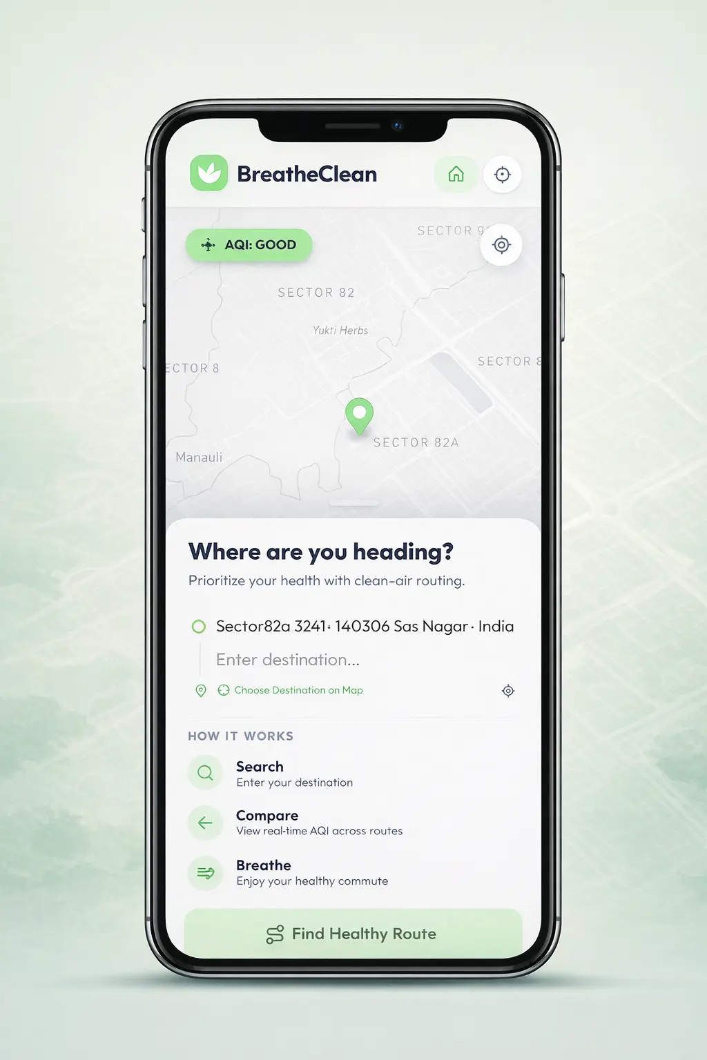
Health-first route planning for the urban commuter. Experience a powerful web tool designed for any browser—prioritizing your lungs with real-time air quality data.
Joined by 100+ healthy commuters online
From
Sunset Blvd, 1202
To
Grand Park Central
Cleanest Route
Via Main St
18m
time
2.4km
dist
Good
AQI
We analyze PM2.5 and Ozone levels in real-time from thousands of sensors to identify pollution hotspots across your browser.
Our proprietary algorithm suggests routes that minimize exposure to harmful pollutants by up to 40% per trip, instantly accessible from any device.
Track your daily, weekly, and monthly air quality exposure trends through your personalized web dashboard.
A simple guide to finding the cleanest air for your journey. Plan, analyze, and breathe easier in just a few clicks.
Start by selecting your starting location and destination. Whether it's a daily commute or a one-time trip, just enter the points and hit search.
Our system processes real-time data to offer 2-3 optimal routes across different transport modes. Each route gets a 'Health Score' based on AQI, PM2.5, traffic, and distance.
Save your frequent routes. If the current air quality score beats your previous best, we'll send you a 'Gem Email'—letting you know the perfect time to leave.
Access your saved routes anytime. You can delete old paths, review details, or click 'Start' to begin your cleanest journey yet.
We pull live air quality, weather, and traffic data along every route segment to give you an accurate Health Score before you step outside.
Live AQI and PM2.5 readings sampled at multiple breakpoints along your route, powered by the AQICN network.
Real-time temperature, humidity, and wind data from OpenWeather to factor in how weather affects pollutant dispersion.
Mapbox-powered routing with live traffic data ensures your Health Score accounts for time spent in congested zones.
Each route is scored using a weighted formula — 40% weather, 30% AQI, 30% traffic — so you always pick the cleanest path.

BreatheClean empowers urban commuters with real-time pollution data, helping you avoid harmful air and choose the healthiest path forward.
Our routing algorithm avoids major pollution hotspots in real-time.
Urban air pollution is one of the biggest health crises of our time. We realized that while we can't always control the air quality of our city, we can control our exposure to it.
BreatheClean started as a simple idea: what if your maps app cared as much about your lungs as it did about your arrival time?
Today, we're building the world's most advanced health-first navigation engine, powered by a passionate community of open-source contributors.
"BreatheClean has completely changed how I get to work. I used to arrive feeling congested, but now I take the cleanest route and feel energized."
"As someone who bikes everywhere, knowing the air quality along my route is game-changing. The 'Gem Alerts' are my favorite feature!"
"Finally, a tool that makes complex air quality data accessible and actionable for the average person. A massive step forward for public health."
The talented developers dedicating their time to making breathable air accessible for everyone.

Full-stack enthusiast focused on creating intuitive user experiences and optimization.
View Profile
Passionate about building scalable web applications and solving real-world problems through code.
View Profile
Backend developer interested in system design, authentication, data modeling, and building reliable services
View ProfileJoin over 100+ active users who have already reduced their daily pollutant exposure. BreatheClean is a powerful, web-first platform accessible instantly from any browser—no downloads required.